English   Română   Español   Français   Deutsch  

getamap.net

Africa

Oceania

Asia

North America

Europe

South America

Antarctica


Mro oua Longoni

/ Mayotte (general)

12°43'45" S
45°9'32" E
~302m asl
20:53 (EAT - UTC/GMT+3)

Mro oua Longoni (Mro oua Longoni) is a stream (class H - Hydrographic) in Mayotte (general), Mayotte [ France ] (Africa) with the region font code of Africa/Middle East. It is located at an elevation of 302 meters above sea level.

Its coordinates are 12°43'45" S and 45°9'32" E in DMS (Degrees Minutes Seconds) or -12.7292 and 45.1589 (in decimal degrees). Its UTM position is NL19 and its Joint Operation Graphics reference is SD38-02.

Current local time is 20:53; the sun rises at 08:53 and sets at 21:00 local time (Indian/Mayotte UTC/GMT+3). The standard time zone for Mro oua Longoni is UTC/GMT+3
In 2024 DST starts on - and ends on -.

A Stream is a body of running water moving to a lower level in a channel on land.


Country
 Advertisements:


 Advertisements:


Weather Mro oua Longoni (Cloud cover, Temperature, Wind speed and Precipitation mm probab.)

Sun


Apr 28
Clound 10-20-10-30
 
29 °C min
30 °C max
32 km/h
Thu Jan 1

Mon


Apr 29
Clound 20-10-0-100
~10 l/m2 38%
 
28 °C min
30 °C max
28 km/h
Thu Jan 1

Tue


Apr 30
Clound 50-40-60-100 Lightning
~23 l/m2 88%
 
27 °C min
29 °C max
26 km/h
Thu Jan 1

Wed


May 1
Clound 30-60-80-100 Lightning
~15 l/m2 66%
 
27 °C min
29 °C max
30 km/h
Thu Jan 1

Thu


May 2
Clound 40-60-100-100 Mist Lightning
~43 l/m2 95%
 
26 °C min
29 °C max
52 km/h
Thu Jan 1

Fri


May 3
Clound 50-90-100-100 Mist Lightning
~498 l/m2 97%
 
26 °C min
28 °C max
88 km/h
Thu Jan 1

Weather Graph

Mro oua Longoni (Mayotte (general)) 7 day forecast
 

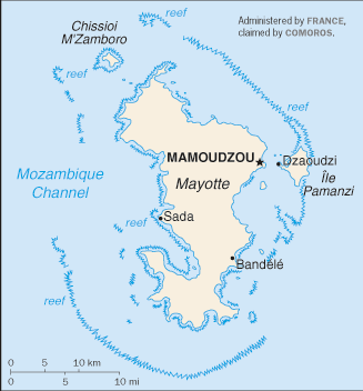
Map and Photos Mro oua Longoni


Comments

--- There are no comments yet ---


Add a new comment:


You have to log in to add a comment!


Members area


Register

Forgot password?

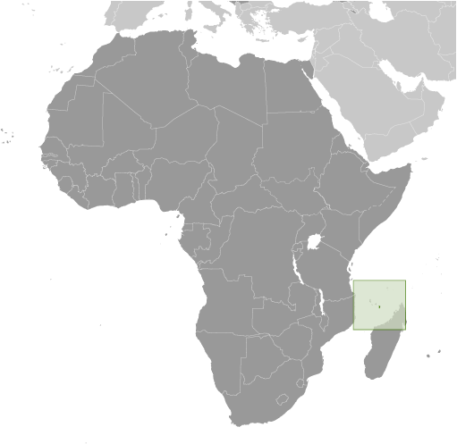
Mayotte [ France ] (Overseas Territory):

Advertisement


GPS points near Mro oua Longoni

square Longoni (0.5km)


square Tririni (0.5km)


square Miangani (1 km)


square Ile Verte (1 km)

square Mitseni (1 km)

square Ile Blanche (2 km)


square Bouilloni (2 km)

square Bouyouni (2 km)


square Bandramaji (2 km)

square Kangani (2 km)


GPS points from Mayotte [ France ] (Overseas Territory)

square Mtsanga Hadsale M'tsangamouji

square Tsoha Mayotte (general)

square Mlima Chirongui Mayotte (general)

square Banc Boa Sadia Mayotte (general)

square Mlima Mare Mayotte (general)

square Recif Rani Mayotte (general)

square Mrereni Be Mayotte (general)

square Mro Oua Haoutoungou Mayotte (general)


viewweather.com sv.ViewWeather.com
fr.ViewWeather.com
da.ViewWeather.com
de.ViewWeather.com
es.ViewWeather.com
www.carpati.org
www.searchromania.net
Deblocari usi
es.getamap.org
fr.getamap.org
de.getamap.org
nl.getamap.org
da.getamap.org
www.getamap.org
Links
Terms of use
Privacy policy

# 0.0785 sec 

contact AT getamap.net

© 2006 - 2024  https://www.getamap.net/